Coast
Harbour-hopping the East Neuk: Crail to Elie on the Fife Coastal Path
Five fishing villages, one stretch of coast path, a lot of salt air and fish suppers. How to walk, bus and eat your way along Fife's eastern corner from Crail to Elie.
By VacationGuide Editors · · 6 min read
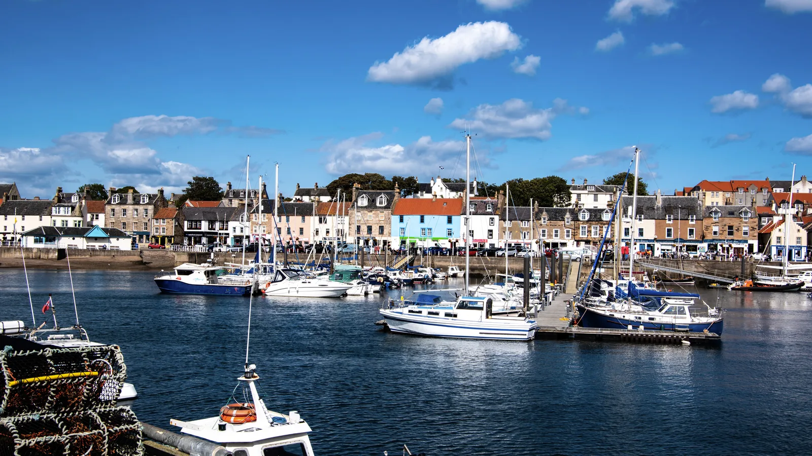
The East Neuk is the knuckle of Fife that pushes out into the North Sea, and its villages sit so close together that you can see the next harbour wall from the last one. Crail, Cellardyke, Anstruther, Pittenweem, St Monans and Elie are strung along the Fife Coastal Path like beads, each with its own pier, its own kirk and its own opinion about who fries the best haddock. This is our guide to harbour-hopping them on foot, from the old royal burgh of Crail to the sandy bays of Elie, with the caves, windmills and chip shops that make the walk worth the blisters.
Start in Crail: the postcard harbour
Crail is a royal burgh of long standing – it was made one in 1178 under William the Lion. Its harbour is the one that ends up on calendars: a tight little basin where the inner walls are built with an unusual vertical coursing of stones. The east pier was described as "new foundit" in 1610 and as "old and ruinous" less than a century later; the west pier was rebuilt by Robert Stevenson in 1828.
Before you leave, find the Tolbooth on the edge of the old marketplace; its tower dates from about 1600. The weathervane on top is not a cockerel but a smoked haddock, known locally as a "Crail Capon" – which tells you most of what you need to know about the town's priorities. Crail's fishing was historically more local than Anstruther's or Pittenweem's, with an emphasis on shellfish.
Golfers should note that the Crail Golfing Society dates from 1766, and its Balcomie Links was formally laid out by Old Tom Morris in 1894. If you'd rather tee off than walk, a little further up the coast are Kingsbarns Golf Links and, at the far end of our route, The Golf House Club in Elie.
Crail to Anstruther: caves and salt works
Heading south-west out of Crail, the path runs over open pasture and along the shore, passing the remains of old salt works and the Caiplie Caves, a cluster of weathered sandstone hollows between Crail and Cellardyke. The Fife Coast and Countryside Trust warns that livestock may graze the open ground after Cellardyke at certain times of year, and that the ground can be rough, with short stone steps that get slippery – stout footwear, not trainers.
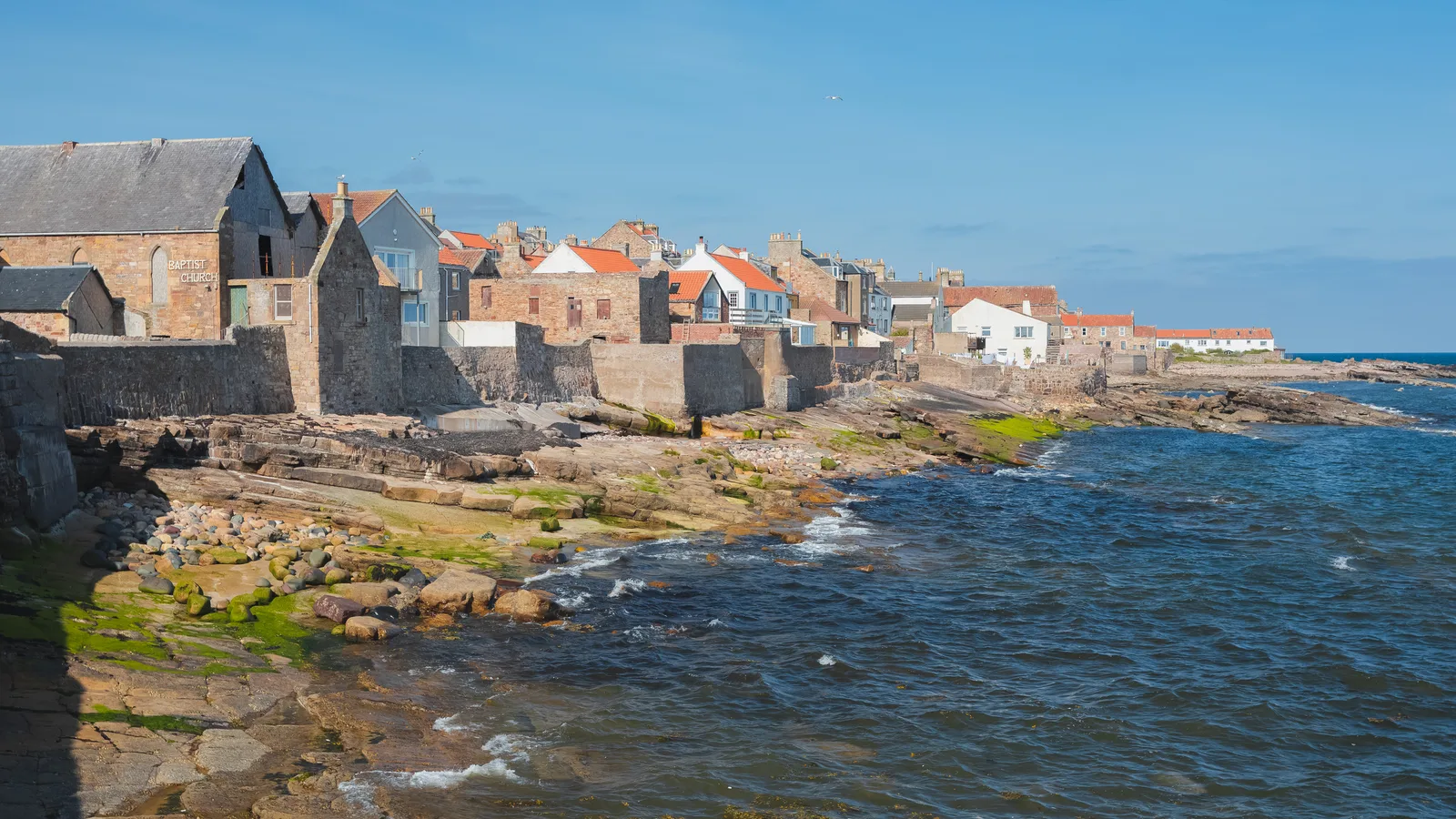
Cellardyke runs straight into Anstruther, and you'll barely notice the join. Look out for Tide Line, a stone art installation by Julie Brook commissioned for the 2025 Beach of Dreams festival; it shows at low tide and is best seen in the couple of hours either side of high water.
Anstruther: the big harbour and the fish supper
Anstruther is the largest of the East Neuk villages and the natural lunch stop. Its fish and chips have a long-standing reputation – the Anstruther Fish Bar is the name you'll hear most – and there's no shame in eating them on the harbour wall.
Before or after, give an hour to the Scottish Fisheries Museum. It opened in 1969 in a group of buildings around a cobbled courtyard, including a 16th-century Abbot's lodging and an 18th-century merchant's house, both Category A listed. The collection runs to more than 66,000 items, from model boats to paintings and fishing gear, and was given Recognised Collection status in 2007. Moored opposite the museum when she isn't sailing is Reaper, a twin-masted Fifie herring drifter built in 1900.
Anstruther is also where you catch the boat to the Isle of May, the national nature reserve out in the firth. NatureScot lists the May Princess and the faster, smaller Osprey Rib sailing from Anstruther, with tickets from the office by the lifeboat station. The island is open to visitors from spring to the end of September; you'll be asked to clean mud off your boots and use the disinfectant footbaths because of avian influenza.
Pittenweem and St Monans: caves and a windmill
Pittenweem is the most active fishing port on this coast, and on a working morning it still looks the part. Its name is usually explained as Pictish pett plus Gaelic na h-Uaimh: "the place of the caves". The cave in question is St Fillan's, the oldest structure in the village, associated with the saint in the 7th century and rededicated as a place of worship in 1935. In the 13th century an Augustinian priory moved here from the Isle of May and was built over it.
The village also hosts the Pittenweem Arts Festival, founded in 1982, which now draws crowds well beyond its size – if you're planning around it, book accommodation early.
Between Pittenweem and St Monans you pass the restored St Monans Windmill, which once pumped seawater into the salt pans beside it. The limestone along this bit of shore is rich in fossils, so watch your feet for more than one reason. St Monans itself has a 14th-century church set almost on the rocks and a zig-zagging pier; the East Pier Smokehouse, overlooking the harbour, is a good place to rest.
West of the village, beyond the ruins of Newark Castle, there's a low-tide route along the shore and a high-tide diversion that skirts fields and crosses a bridge before rejoining near the church. Check the tide times before you set out.
Elie: Lady's Tower and the chain walk
The last leg brings you past Ardross Castle ruins into Elie, where the coast softens into sandy bays. Out on the point stand Elie Lighthouse and the Lady's Tower, built in the 1760s as a summer house for Lady Janet Anstruther. Ruby Bay, just below, takes its name from the red garnets once found on the beach.
For the adventurous, the Elie Chain Walk runs for about a kilometre along the base of the cliffs down to tidal beaches, with eight sets of chains and carved footholds dating back to the 1920s. It is genuinely hazardous, and even its fans say so. Our advice: check the tide times, go in dry weather with good grip, and skip it if you have any doubt.
If you only have one day
Our pick: start in Anstruther, see the museum, walk west through Pittenweem and St Monans to Elie, and finish at the Lady's Tower for the light over the firth. It's the most varied section – fishing harbour, cave, windmill, castle ruins, beach – and you can return by bus. If you have two days, add Crail to Anstruther as a morning walk and take the Isle of May boat in the afternoon (in season).
Plan it
- Getting around: The full Fife Coastal Path stage from Elie to Cambo Sands, which takes in all of these villages, is about 16 miles and five to six hours. The 95 bus links the coast villages, so you can walk one way and ride back.
- Tides: Several sections, including the shore route near St Monans, are tidal. Check tide tables and follow the signed high-tide diversions.
- Where to base yourself: Stay in one of the villages, or use St Andrews as a base – Stewart's Resort Lodges and St Andrews Holiday Park both put you within reach of the coast, and you can add the Cathedral and West Sands on a rest day.
- Best time of year: For the Isle of May, go between April and September. For the walk itself, spring and early autumn are quieter.
- Booking tips: Book Isle of May boats with the operator in advance, and reserve accommodation early if you're coming for the Pittenweem Arts Festival.
Ready to go? Build a day-by-day plan for the East Neuk of Fife.
Plan a trip to the East Neuk of FifePlaces in this guide
Frequently asked questions
- How long is the walk from Crail to Elie?
- The Fife Coastal Path stage from Elie to Cambo Sands, which passes through all the East Neuk villages, is about 16 miles and takes five to six hours. Crail to Elie is most of that, so you can split it over two days or use the 95 bus.
- Can I visit the Isle of May from Anstruther?
- Yes. Boats including the May Princess and the Osprey Rib sail from Anstruther, with tickets sold by the lifeboat station. The island is open to visitors from spring to the end of September.
- Is the Elie Chain Walk safe?
- It is potentially dangerous. It runs about a kilometre along the base of the cliffs with eight sets of chains, and parts are tidal. Check the tide times, go in dry weather with good footwear, and treat it as optional.
Sources
- fifecoastandcountrysidetrust.co.uk/?p=4104
- countryfile.com/go-outdoors/walks/elie-to-cambo-sands-fife-scotland/
- en.wikipedia.org/wiki/Crail
- en.wikipedia.org/wiki/Pittenweem
- en.wikipedia.org/wiki/Scottish_Fisheries_Museum
- nature.scot/enjoying-outdoors/visit-our-nature-reserves/isle-may-nnr/isle-may-nnr-visiting-reserve
- inkl.com/news/the-coastal-scottish-town-with-a-chain-trail-that-lets-visitors-walk-along-cliffs
Related guides
Coast · Northumberland
Northumberland's castle coast: Bamburgh, Holy Island and the Farnes
A short stretch of Northumberland coast holds a royal fortress, a tidal island where English Christianity took root and a seabird colony reached by boat from Seahouses.
5 min read
Coast · Pembrokeshire
Pembrokeshire's coast: Barafundle, St Davids, Skomer and the coast path
A long weekend or a week on Wales's far western coast: the walk-in beach at Barafundle, Skomer's puffins, Britain's smallest city and the 186-mile coast path.
5 min read
Coast · Cornwall
The UK's top hidden beaches
Coves and strands that stay quiet even in August — if you're willing to walk.
11 min read