Coast
Pembrokeshire's coast: Barafundle, St Davids, Skomer and the coast path
A long weekend or a week on Wales's far western coast: the walk-in beach at Barafundle, Skomer's puffins, Britain's smallest city and the 186-mile coast path.
By VacationGuide Editors · · 5 min read
Pembrokeshire is the part of Wales that runs out of land. Its coast twists for mile after mile of cliffs, coves and headlands, with offshore islands full of seabirds and a cathedral city so small it feels like a village. You can do it justice in a long weekend if you focus, or settle in for a week and walk a good chunk of the coast path. Either way, these are the four places we'd build a trip around, and how to fit them together.
The coast path: the thread that ties it all together
The Pembrokeshire Coast Path is the backbone of any visit. It's a National Trail of 186 miles (299km), running from the bridge east of Amroth Castle in the south to the slipway north of St Dogmaels near Cardigan, with a plaque at Poppit Sands marking the northern end. It was approved in 1953 and opened on 16 May 1970, and it's now part of the wider Wales Coast Path.
Don't let the numbers frighten you. The full trail involves around 35,000 feet of ascent and descent, which is why most visitors walk it in sections. That's where Pembrokeshire's coastal buses come into their own. The Puffin Shuttle, Strumble Shuttle, Celtic Coaster, Poppit Rocket and Coastal Cruiser run along the National Park coastline on a hail-and-ride basis: you flag them down on the coast road. They run seven days a week from May to September and twice a week in winter, and dogs and buggies are welcome. Our favourite way to walk here is linear: catch a bus out in the morning and walk back to your car or your bed.
Barafundle Bay: worth the walk
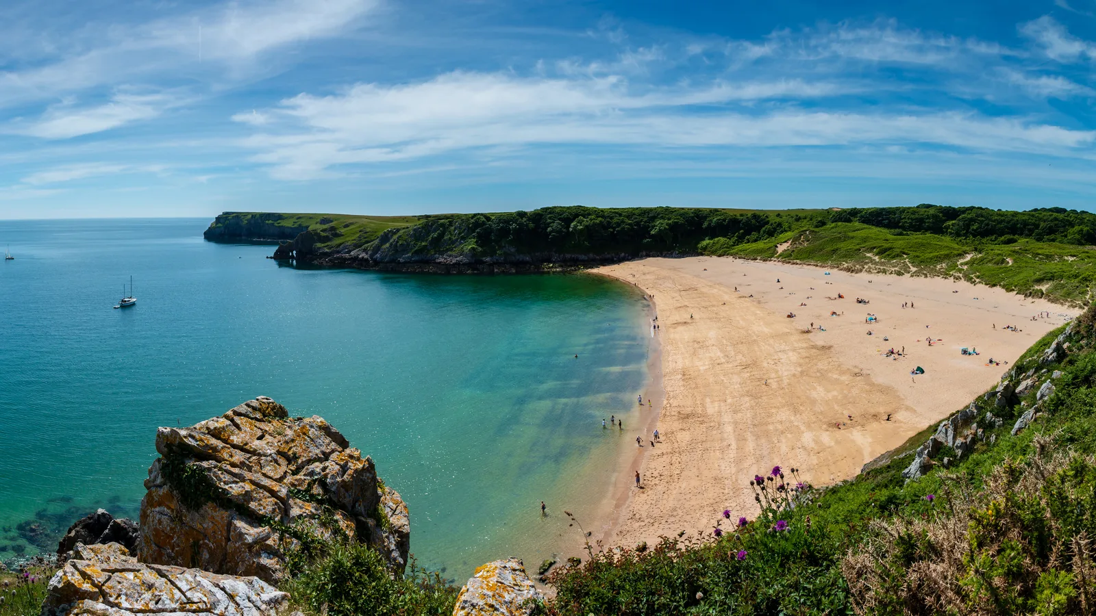
Barafundle Bay is the beach that ends up on every Pembrokeshire poster, and the reason it stays beautiful is that you can only get there on foot. It sits on the National Trust's Stackpole Estate, around 3,000 acres of Grade I listed historic landscape on the coast path.
The usual approach is from the car park at Stackpole Quay, about half a mile away. The path includes steps and uneven ground, so it isn't suitable for wheelchairs, pushchairs or anyone unsteady on their feet. There are no facilities at the beach itself: toilets are back at Stackpole Quay, and so is the Boathouse tea-room. Pack what you need for the day and carry everything out again.
Dogs are allowed under close control, though you may need a lead because of grazing animals and ground-nesting birds. If you have time, combine Barafundle with the Bosherston Lily Ponds trail, a walk of about a mile through the dunes and pools of the Mere Pool Valley behind Broad Haven South beach. It's a gentle, wildlife-rich contrast to the clifftops. One practical note: buses, coaches and campervans aren't allowed at the Stackpole car parks because the roads are narrow.
St Davids: a cathedral city in miniature
St Davids is the UK's smallest city by population, and it had its city status formally reinstated by the Queen in 1995. The reason it's a city at all is St Davids Cathedral. St David founded a monastic community here around 589, and the present building was begun in 1181.
Step inside and the first thing you'll notice is the floor: it slopes by nearly four metres from east to west. The second is the sense of pilgrimage that still hangs about the place. In 1123 Pope Calixtus II decreed that two pilgrimages to St Davids were equal to one to Rome, which made this corner of Wales one of the great destinations of medieval Christendom. Next door, the ruins of the Bishop's Palace, built under Bishop Gower, are now a picturesque ruin.
Give yourself time to walk out of the city too. Tradition says David was born at St Non's, just to the south, where St Non's Well overlooks St Brides Bay and the coast path. About two miles west, Whitesands Bay is a popular surfing beach, and offshore lies Ramsey Island, across Ramsey Sound.
Skomer: the island of puffins
If there's one experience that justifies timing your trip around it, it's a day on Skomer Island. The island is a National Nature Reserve, and between April and July you can get within a few feet of its puffins. They arrive from mid-April, are present from May to July and begin leaving from mid-July; by the end of July they've gone. May brings bluebells, and grey seals pup from late August into October.

Getting there takes planning:
- Boats leave from Martin's Haven, near Dale. Park at Martin's Haven and check in at Lockley Lodge an hour before departure.
- Pembrokeshire Islands Boat Trips is the only operator landing on Skomer, and day tickets must be booked online in advance. Visitor numbers are capped at 250 a day, so book as soon as you can.
- Landing trips run from April to August, Tuesday to Sunday, with a reduced service in September. There are no day boats on Mondays, except the late-May (Whitsun) bank holiday.
- Boats are cancelled in bad weather, so keep a flexible day either side.
Bring food, water and layers. Once you're on the island, you're there until your boat back.
Our verdict: a long weekend or a week?
If you only have a long weekend: Day one, Barafundle and Bosherston from Stackpole. Day two, Skomer, booked well in advance and with a backup day. Day three, St Davids, the cathedral and a stretch of coast path to St Non's or Whitesands.
If you have a week: Add sections of the coast path linked by the coastal buses, a day around the islands off St Davids, and slower days on the beaches. A week also gives you room to absorb a Skomer weather cancellation without losing it altogether.
Either way, our advice is the same: don't try to see the whole county from the car. Pembrokeshire is best on foot.
Plan it
- Getting there: By rail, stations at Haverfordwest, Milford Haven and Fishguard connect with local buses, including Fflecsi on-demand services, which can be booked through the app or by phone. The coastal buses reach the whole length of the coast path.
- Where to base yourself: For a short trip, split your stay between the south (for Stackpole and Barafundle) and the St Davids peninsula (for the cathedral, Skomer and the northern coast). For a week, one base in the middle of the county with bus access works well.
- Best time of year: May to July for puffins on Skomer, plus the full summer bus timetable. Late August to October for seal pups and quieter beaches.
- Booking tips: Book Skomer landing tickets as early as possible; booking for the following season opens in the winter. Arrive early at Stackpole Quay in summer, and check coastal bus timetables before you set out on a linear walk.
Ready to go? Build a day-by-day plan for Pembrokeshire.
Plan a trip to PembrokeshirePlaces in this guide
Frequently asked questions
- How do you get to Barafundle Bay?
- Barafundle can only be reached on foot. The nearest car park is the National Trust's at Stackpole Quay, about half a mile away; the path has steps and uneven ground, so it is not suitable for wheelchairs or pushchairs.
- When can you see puffins on Skomer?
- Puffins arrive from mid-April, are present from May to July and leave from mid-July, with all gone by the end of July. Landing trips leave from Martin's Haven and must be booked online in advance.
- How long is the Pembrokeshire Coast Path?
- The National Trail is 186 miles (299km), from Amroth in the south to St Dogmaels near Cardigan in the north, with around 35,000 feet of ascent and descent. It opened in 1970.
Sources
- pembrokeshirecoast.wales/coast-path/coast-path-fact-file
- nationaltrust.org.uk/visit/wales/barafundle-bay
- visitwales.com/activity/skomer-island-landing-trips-1837467
- welshwildlife.org/node/1907
- en.wikipedia.org/wiki/St_Davids_Cathedral
- en.wikipedia.org/wiki/St_Davids
- visitpembrokeshire.com/explore-pembrokeshire/getting-around
Related guides
Coast · The East Neuk of Fife
Harbour-hopping the East Neuk: Crail to Elie on the Fife Coastal Path
Five fishing villages, one stretch of coast path, a lot of salt air and fish suppers. How to walk, bus and eat your way along Fife's eastern corner from Crail to Elie.
6 min read
Coast · Northumberland
Northumberland's castle coast: Bamburgh, Holy Island and the Farnes
A short stretch of Northumberland coast holds a royal fortress, a tidal island where English Christianity took root and a seabird colony reached by boat from Seahouses.
5 min read
Coast · Cornwall
The UK's top hidden beaches
Coves and strands that stay quiet even in August — if you're willing to walk.
11 min read